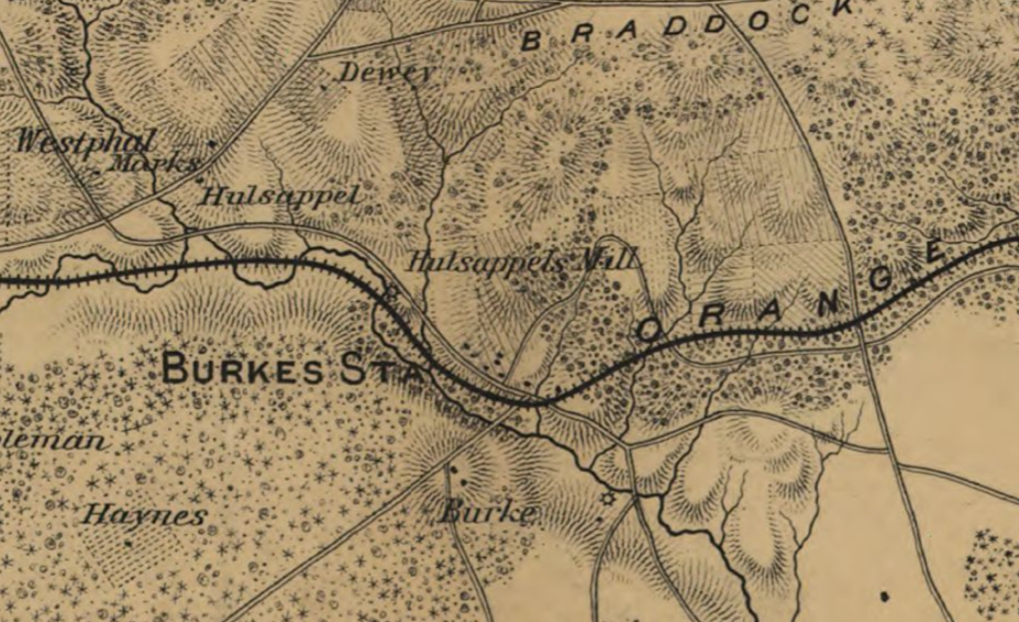
Historic Maps of Burke, No. 1
In 1862, the United States was in the middle of a civil war. Maps were a key part of fighting an effective and strategic war. This map was created by engineers working for General Irwin McDowell, a career soldier of the United States Army and the chief commander of the troops at the Battle of 1st Bull Run (or 1st Manassas).

